It's Cool Now, but Valley Will Near Triple Digits by Friday


Share
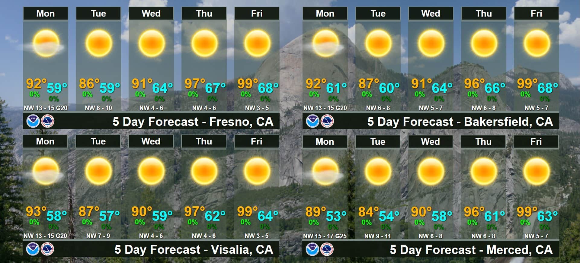
Are you enjoying the cooler than normal temperatures in Fresno and throughout the San Joaquin Valley?
They will be around for a few more days until near triple-digit afternoon highs return on Friday, the National Weather Service in Hanford says.
Monday’s high is expected to hit 92 degrees in Fresno and Bakersfield. And Tuesday’s forecast calls for a drop into the mid-80s throughout the Valley. Then the warm-up begins.

Wind Advisory Begins Monday Night
A wind advisory will go into effect at 5 p.m. Monday and end at 5 a.m. Tuesday.
Winds are expected to average 10 mph to 20 mph on the west side, with gusts reaching 35 mph. In the mountains and deserts of Kern County, gusts could reach 50 mph.
RELATED TOPICS:
Categories

Latest
Videos