


|
Getting your Trinity Audio player ready...
|
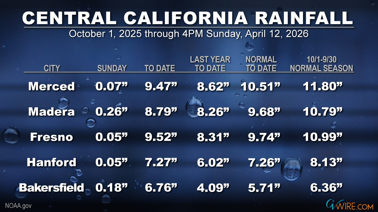
Fresno received nearly a fifth of an inch of rain in a 20-minute thunderstorm Sunday afternoon that flooded some streets.
Thunderstorms also doused Fresno and other nearby communities Saturday night and early Sunday morning.
The bursts pushed the city’s total for the Oct. 1 to Sept. 30 water season to 9.52 inches and 98% of normal, according to the National Weather Service.

So, what’s ahead in the forecast?
“Lingering precipitation and thunderstorms remain possible for much of the Sierra Nevada and adjacent foothills” on Tuesday afternoon, NWS Hanford said in its Monday morning forecast discussion.
Beyond that, the weather service forecasts dry skies and warmer temperatures into the weekend.
However, NWS estimate a 10% to 30% chance for rain in the Sierra and a less than 15% chance for the Valley next week.
Snowpack Outlook Is Dismal
Despite the state receiving ample rain this winter and spring, California’s snowpack outlook is dismal after a record March heatwave.
The state snowpack is 23% of normal and most noticeably is just 12% in northern California. The central and southern Sierra are 27% and 28%, respectively.
“It feels like we skipped spring this year and dropped straight into a summer heatwave,” said Karla Nemeth, director of the Department of Water Resources in a news release.
“What should be gradual snowmelt happened suddenly weeks ago. To me, this is another reminder that aging water systems need to be retrofit for more volatile precipitation patterns. We’re seeing fewer, warmer storms and shorter wet seasons. Future water supplies will depend upon our ability to capture water when it’s available and manage it more efficiently.”
Said Andy Reising, manager of DWR’s Snow Surveys and Water Supply Forecasting Unit:
“What makes this year stand out is the disconnect between precipitation and snowpack. We received near-average precipitation in many parts of the state, but much of it fell as rain instead of snow. That led to one of the lowest April snowpacks on record and one of the earliest peaks we’ve seen in decades — conditions that make forecasting runoff more complex.”
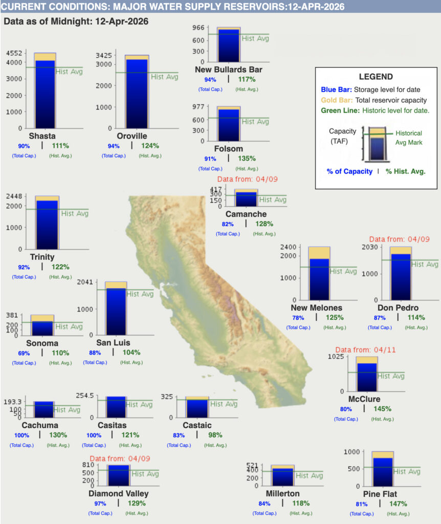
San Joaquin Valley Reservoirs Flush With Water
Despite spring water releases, local reservoirs are filled above their historical levels for this time of year.
Pine Flat is at 147% of its average, Millerton is at 118%, and San Luis sits at 104%.
Farther north, McClure is holding 145% of its historical average, followed by New Melones (125%) and Don Pedro (114%)
The big daddies of the state’s water system in Northern California, Shasta and Oroville, also exceeded their historical averages through Monday morning.