
|
Getting your Trinity Audio player ready...
|
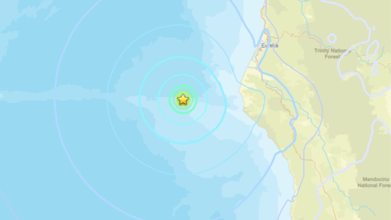
A magnitude 5.1 earthquake struck off the coast of Northern California on Wednesday, according to the U.S. Geological Survey.
The earthquake occurred at 5:45 a.m. PT, about 40 miles west of Petrolia in Humboldt County, the Northern California Seismic Network reported.
The quake was centered at 40.360 degrees north latitude and 125.045 degrees west longitude in the Pacific Ocean. It had a reported depth of about 0.1 miles, making it a very shallow event.

Scientists calculated the earthquake’s magnitude at 5.08 on the moment magnitude scale. The event was detected using data from 231 seismic stations and 202 seismic phases.
The earthquake’s location was determined with an uncertainty of about 0.8 kilometers, while the depth estimate carried an uncertainty of about 3.5 kilometers.
The event was reviewed by a scientist and cataloged by the Northern California Seismic Network.
—
Connect with Anthony W. Haddad on social media. Got a tip? Send an email.