

|
Getting your Trinity Audio player ready...
|
Mother Nature is getting ready to send a whole lot of weather Fresno’s way starting Tuesday.
The Christmas week forecast from the National Weather Service in Hanford includes:
- Heavy rains Wednesday through Friday
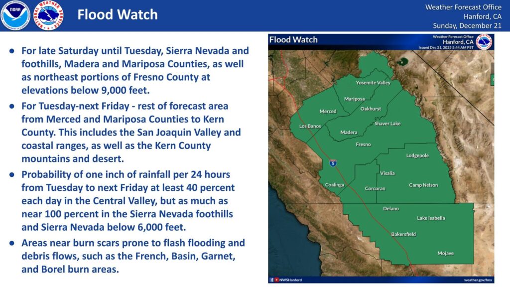
- Potential flooding Tuesday through Friday, especially in burn scar areas such as French, Basin, Garnet, and Borel
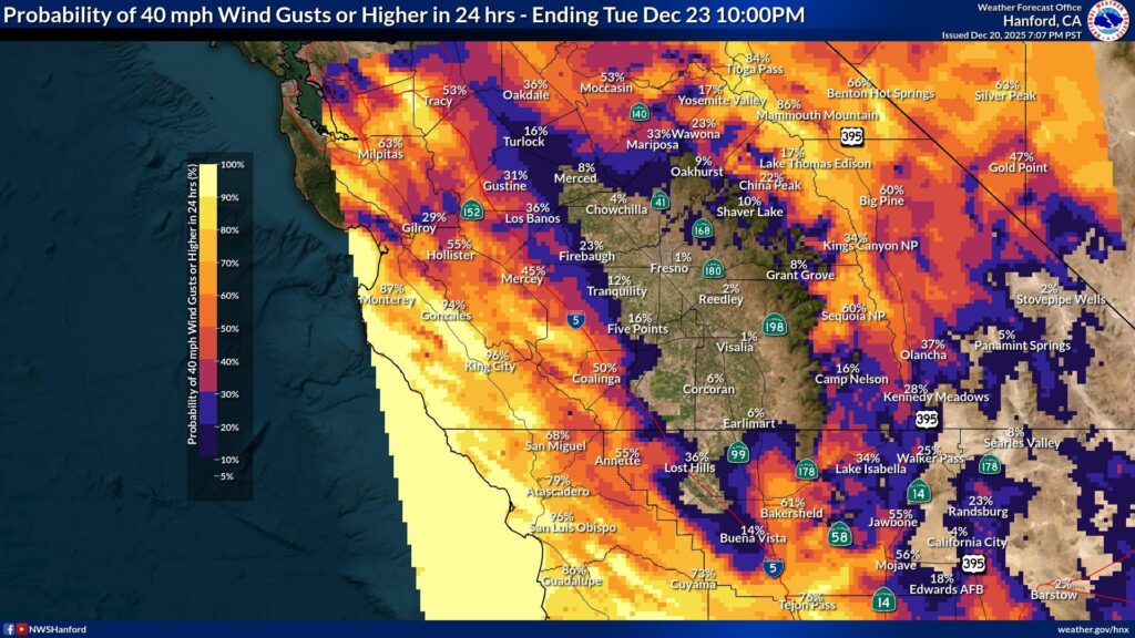
- Wind gusts of 40 mph in the westside hills and southern San Joaquin Valley
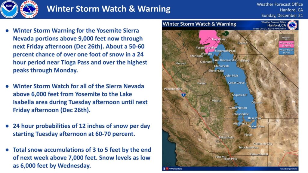
- Large accumulations of snow, first at the higher elevations and then dropping to 6,000 feet
- “Travel may be difficult to impossible over the passes through the Sierra due to snow and high winds,” says NWS Hanford
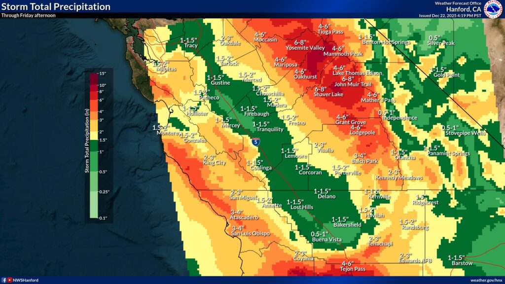
How Much Rain for Fresno?
So, what is considered heavy rainfall?
According to NWS Hanford, the Central Valley could see an inch of rain daily Tuesday through Friday.
NWS Hanford also says there is a 60% to 70% chance of a foot of snow daily beginning Tuesday in the Sierra.
“Total snow accumulations of 3 to 5 feet by the end of next week,” NWS Hanford said in a social media post. “Snow levels as low as 6,000 feet by Wednesday.”
Related Story: Fresno Can Expect Sprinkles Followed by a Wet Christmas Week
What Is Driving the Weathermaker?
A strong storm developing off the coast is expected to mix with a low-pressure system and create colder air in the Sierra.
This will bring an end to the Sierra’s snow drought, add to the snowpack, and enable skiers and snowboarders to have fun once the winds subside.
If you’re thinking of heading to Mammoth to hit the slopes, be forewarned. There’s a high likelihood of travel disruptions along Highway 395.