

|
Getting your Trinity Audio player ready...
|
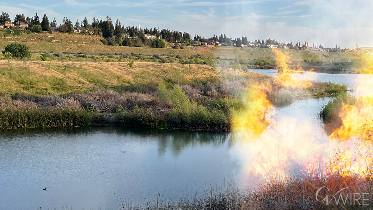
When fires ravaged Chico and Paradise in 2018, most of the homes built there came before modern state mitigation standards, said Frank Bigelow, deputy director of community wildfire preparedness and mitigation with CalFire.
Now, the statewide agency has new threat designations for areas much closer to urban areas than before. Maps for the Central Valley came out March 10.
California Insurance Commissioner Ricardo Lara assured that the maps shouldn’t mean new insurance rates — as insurance companies use their own maps to determine risk.

“Let me be clear: These updated maps will not affect insurance rates,” Lara said in a statement issued by his office. “For many years, insurance companies have been using alternate wildfire risk tools for determining where they will write and renew policies, and how much premium to charge a policyholder.”
Local jurisdictions are now working on incorporating the stricter building codes into areas they haven’t been before. Beginning Jan. 1, 2026, those standards will have to be implemented in “high” threat areas. While more stringent, Bigelow said the standards make homes 60% more likely to survive a wildfire.
“What we are doing with these maps is somewhat drawing a line in the sand,” Bigelow said. “From this point forward, all of these homes that are being built will be built to a wildfire prepared standard.”
‘High’ Threat Area
Local jurisdictions got their first views of the maps with the new “high” and “moderate” threat areas March 10. Many are working on how this will affect their general plans. Areas considered “very high” treat didn’t have many changes.
That could mean wider roads in some areas for fire access, water storage minimums, and signage.
A Tulare County spokesperson said the Tulare County Fire Department will make recommendations to the board in the coming weeks for how to address CalFire’s standards.
Parts of both Woodlake and Avenal received high threat designations. Calls made to the Avenal city manager weren’t immediately returned.
Woodlake City Manager Ramon Lara said the city is reviewing those parts of town with the Woodlake Fire Protection District. The parts of Woodlake remain undeveloped, but they have long-range plans for single-family homes in some areas, Lara said.
New homes in high threat areas will have to meet Wildland-Urban Interface codes. That could mean fire-resistant siding, roofing, multi-pane windows, Bigelow said. For higher density areas, it helps keep fire from spreading home-to-home.
In rural areas, defensible space is key, Bigelow said. People selling their homes in high threat areas will have to get a defensible space inspection within six months.
“When you build a home you have to build it to the most current wildfire standards,” Bigelow said. “That means fire resistant siding, muti-pane windows, enclosed eaves, a noncombustible roof, a whole host of things that help prepare your home for a wildfire.”

Moderate Threat Areas Include River Bluffs, Madera Ranchos
CalFire created the “moderate” threat designation mostly to create awareness for homeowners, Bigelow said. The designation doesn’t come with the standards mandated for high threat areas, but that could come in three years as part of the next code cycle, Bigelow said.
“We’re taking it under consideration to move into the moderate as well,” Bigelow said.
Moderate threat areas include large swaths of the San Joaquin River bluffs area in northwest Fresno.
Large portions of the Madera Ranchos, including the Tesoro Viejo and Riverstone developments also fall under this designation.
CalFire placed eastern portions of Porterville into the designation as well.
The full state map can be viewed at this link.
Fresno County Supervisor Nathan Magsig said he had been waiting for these maps to come out to see how portions of his district — eastern Fresno County, including the foothill and mountain regions — would be affected.
He was happy to see a lot of those areas not fall into the “very high” threat status.
He said people in Harlan Ranch area of Clovis — which butts near grasslands — are already having trouble getting insurance.