
|
Getting your Trinity Audio player ready...
|
If you’re planning an outdoor activity and want to stay dry, Friday is the day to do it.
Otherwise, the Fresno weather forecast looks a lot like those from recent weeks: rain, showers, rinse, repeat.
This is California, only a few miles south of state capital Sacramento. We’re still officially in a drought. https://t.co/EroMgGwOFH
— Westside Farmer (@JoeDelBosque) January 2, 2023
A low-pressure system will push rain into the Valley and snow into the Sierra beginning Wednesday, according to the National Weather Service in Hanford.

The storm arriving Wednesday and ending Thursday night could dump between one and 1.5 inches of rain on the central San Joaquin Valley, the NWS estimates.
A respite from the precipitation is expected Friday. Then another storm system will soak the Valley and blanket the Sierra over the weekend.
In addition, the Climate Prediction Center indicates there’s a chance of above-average precipitation for next week.
First Snow Survey Results Are In
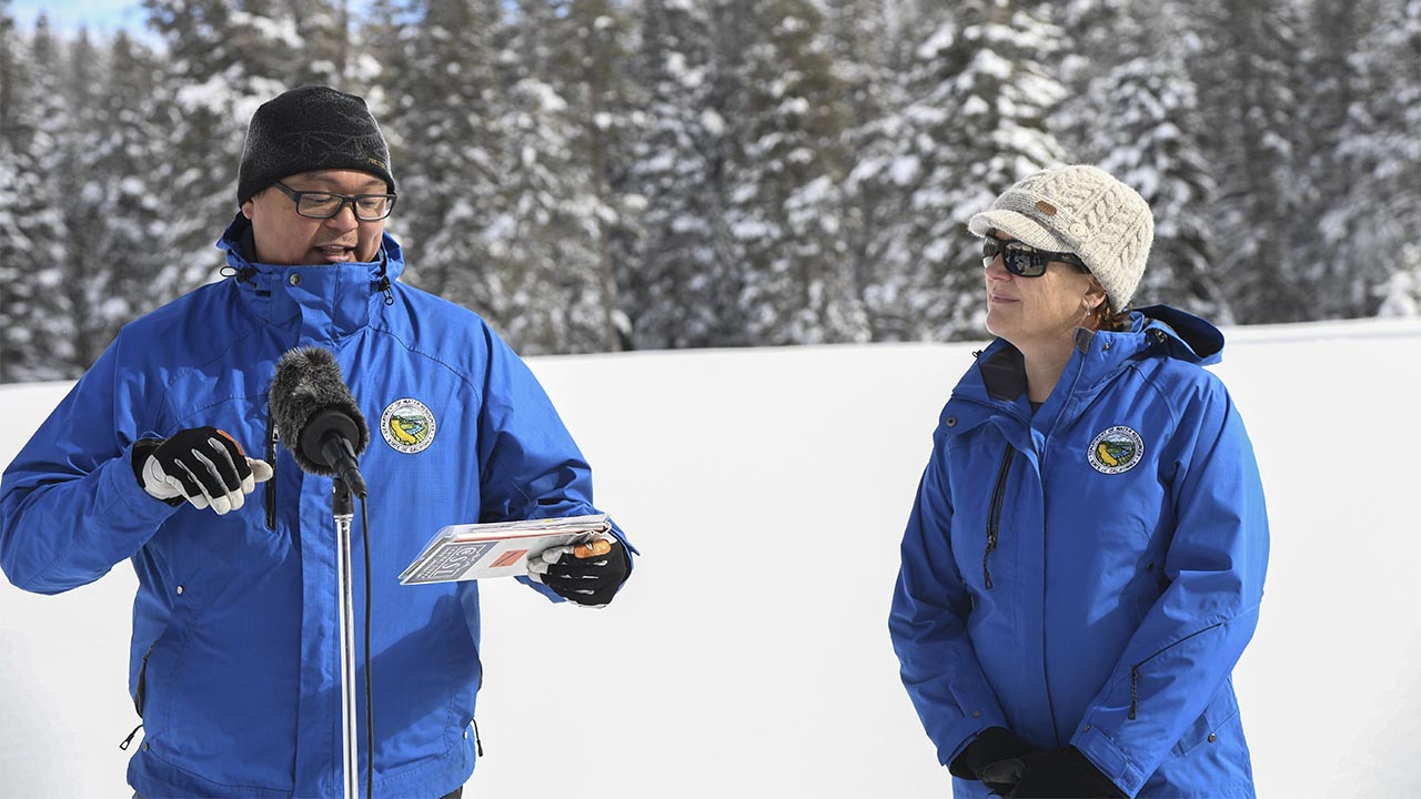
The state Department of Water Resources conducted its first snow survey of the season on Tuesday at Phillips Station near Lake Tahoe.
The manual survey recorded 55.5 inches of snow depth and a snow water equivalent of 17.5 inches, which is 177% of the average for that location. Snow water equivalent measures the amount of water contained in the snowpack and is a key component of DWR’s water supply forecast.
Statewide the snowpack is 174% of “normal” through Jan. 3. For the Southern Sierra, the SWE is 206% of normal for the date.
“The significant Sierra snowpack is good news but unfortunately these same storms are bringing flooding to parts of California,” said DWR Director Karla Nemeth in a news release. “This is a prime example of the threat of extreme flooding during a prolonged drought as California experiences more swings between wet and dry periods brought on by our changing climate.”
The past three years in California have been the driest ever recorded, dating back to 1896. State officials have severely limited water deliveries to farmers while Democratic Gov. Gavin Newsom has urged residents and businesses to conserve water.
Roughly a third of California’s water supply comes from melting snow in the Northern California mountains. About 75% of California’s rain and snow comes from the watersheds north of Sacramento. But about 80% of the state’s water demand comes from Southern California, where most of the people live.
Tollhouse Road Only Route Open to Shaver Lake
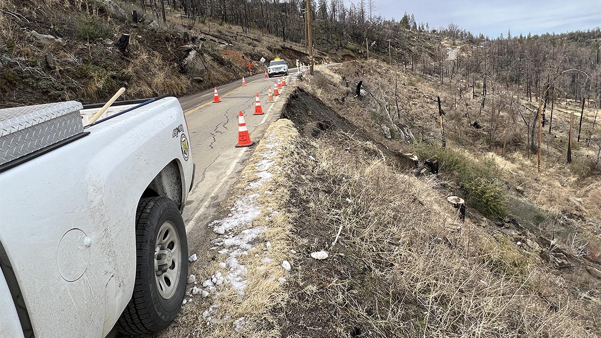
Two key routes leading to Shaver or Huntington lakes are blocked because of rockslides or landslides.
A Flood Watch is in effect for most of Central California Wednesday through Thursday night. Creeks and streams are running high and could flood during prolonged periods of heavy rainfall. Flooding may take place in poor drainage and urban areas. #CAwx pic.twitter.com/jZcWUvzKYf
— NWS Hanford (@NWSHanford) January 3, 2023
Caltrans advises that the Highway 168 “four lane” is closed from 8.4 miles west to 3.5 miles west of Pineridge. In addition, Fresno County officials say that Auberry Road in the Alder Springs area is closed so that crews can repair erosion on the road’s shoulder. The repairs could take up to two weeks, officials say.
The closures leave narrow, winding Tollhouse Road as the lone connector to the Shaver Lake area. The county is running maintenance vehicles on Tollhouse day and night to keep the road open.
“Unless it’s an absolute necessity, we encourage the public not to travel in this area,” county officials advise.
Fresno County Winter Storm Map
Fresno County is providing a winter storm map similar to its online fire evacuation map.
The real-time service allows residents to enter an address to see the different winter storm risk levels. If a storm occurs, the map will activate to display evacuation zones. These areas are listed under three headings: evacuate (red), warning (yellow), no evacuation (green).
Check out the map at this link.
Rainfall Totals
Fresno received 5.43 inches of rain from Oct. 1 through 6 p.m. Monday. That is 161% of normal for the date and nearly half of the average (10.99 inches) for the Oct. 1-Sept. 30 water year.
Reservoir Report
Access all of the daily water levels and historical comparisons for California’s reservoirs at this link.
(Associated Press contributed to this story.)