
If you look up into the Valley skies this week and see a large, oddly shaped device hanging from a helicopter, don’t be alarmed.
It’s part of a research project to map underground water supplies.
Beginning Monday, flyovers are expected in areas west and south of Fresno – including Fowler, Kingsburg, Lemon Cove, Orange Cove, Orosi, Parlier, Piedra, Reedley, Sanger, Selma, Woodlake.

This high flying technique has been used in California before and has been shown to provide useful information that can be used to better manage natural resources.
Why Target the Central Valley?
Researchers from Stanford are leading the project. The goal is to better understand the way groundwater systems in the Central Valley receive water from the Sierra Nevada Mountains.
The specific question of interest in their work: Where are the recharge pathways – the zones of coarse, permeable materials – along the eastern edge of the Central Valley, that can move surface water and/or groundwater from the Sierras into the groundwater systems of the valley?
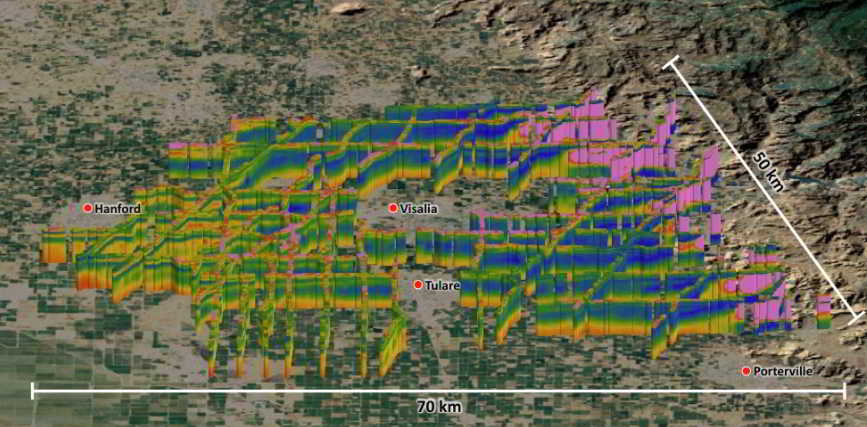
The warm colors show regions where there are coarse-grained sands and gravels. These materials can hold a large amount of water and can move a large amount of water. These are the colors researchers are looking for in the new study – hoping to find the sand and gravel pathways from the Sierras that carry water to great depths in the valley. (Courtesy/gemcenter.stanford.edu/research)
’Spider Web’ Electromagnet Array
Scientific equipment hangs about 100 feet below the helicopter in a ’spider web’ array and is designed to map geologic structures and groundwater resources down to approximately 900 feet below the ground.
The helicopter will be flown by pilots who are specially trained for low-level flying and their flight path is designed to get the best available underground data.
Researchers have successfully used the airborne electromagnetic method in the past in the local area. 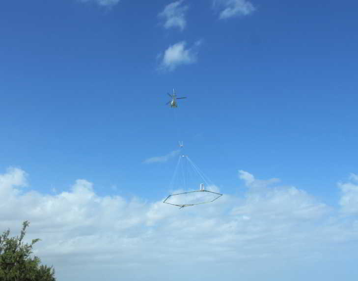
The helicopter strategy has been used all over the world. (Photos courtesy of SkyTEM)
No Data Collection Over Residential Areas
Since data can only be collected over open spaces, no data collection will occur over residential areas, livestock feeding operations, or other buildings.
After the flights, Stanford University will use the data to develop an improved understanding of recharge in the area. An update on their work will be available at https://gemcenter.stanford.edu/research-projects.