A powerful storm batters Northern California with record rainfall, causing widespread damage and travel disruptions. (AP/Noah Berger)

- The storm, classified as a "bomb cyclone," has caused two deaths and left hundreds of thousands without power in Washington.
- Forecasters warn of continued flash flooding and rockslide risks as the strongest atmospheric river of the season persists.
- Travel disruptions include flight cancellations at San Francisco International Airport and limited traffic on Interstate 5 due to snow.
Share
|
Getting your Trinity Audio player ready...
|
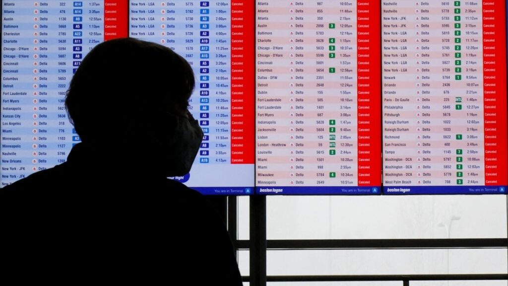
FORESTVILLE — A major storm moving through Northern California on Thursday toppled trees and dropped heavy snow and record amounts of rain after damaging homes, killing two people and knocking out power to hundreds of thousands of customers in the Pacific Northwest. Forecasters warned the risk of flash flooding and rockslides would continue. Scores of flights in and out of San Francisco’s airport were canceled.
In Washington, more than 320,000 people were still without power Thursday as crews worked to clear streets of electrical lines, fallen branches and debris.
Related Story: Blue Skies for Fresno This Weekend. When Will the Next Storm Hit?
Strongest Atmospheric River of the Season
The National Weather Service extended a flood watch into Saturday for areas north of San Francisco as the region was inundated by the strongest atmospheric river — a long and wide plume of moisture that forms over an ocean and flows through the sky over land — so far this season. The storm system roared ashore Tuesday as a “bomb cyclone,” unleashing winds that brought down trees and left two dead in Washington.
Up to 16 inches (about 41 centimeters) of rain was forecast in southwestern Oregon and the northern counties of California through Friday. The Sonoma County Airport, in wine country north of San Francisco, received 6.92 inches (17.5 centimeters) of rain Wednesday, breaking a record dating to 1998.
In nearby Forestville, one person was hurt when a tree fell on a house. Small landslides were reported across California’s North Bay region, including one on State Route 281 on Wednesday that caused a car crash, according to Marc Chenard, a weather service meteorologist.
Rain slowed somewhat but “persistent heavy rain will enter the picture again by Friday morning,” the weather service office in San Francisco said on X. “We are not done!”
Related Story: When Will the Rain Arrive in Fresno? (Hint: Turn Off Your Sprinklers)
Dangerous Conditions and Potential Flooding
Dangerous flash flooding, rockslides and debris flows were possible, especially where hillsides were loosened by recent wildfires, officials warned. Scott Rowe, a hydrologist with the weather service in Sacramento, said so far the ground has been able to absorb the rain in California’s Butte and Tehama counties where the Park Fire burned over the summer.
“It’s not necessarily how much rain falls; it’s how fast the rain falls,” Rowe said Thursday.
The storm system, which first hit the Pacific Northwest on Tuesday, reached the status of ” bomb cyclone,” which occurs when a cyclone intensifies rapidly.
A winter storm watch was in place for the northern Sierra Nevada above 3,500 feet (1,066 meters), where 15 inches (38 cm) of snow was possible over two days. Wind gusts could top 75 mph (121 kph) in mountain areas, forecasters said.
Widespread Power Outages and Travel Disruptions
The storm had already dumped more than a foot of snow along the Cascades by Wednesday evening, according to the National Weather Service. Forecasters warned of blizzard and whiteout conditions and near impossible travel at pass level.
In Washington, there were more than 320,000 power outage reports Thursday morning from strong winds and rain on Tuesday night, according to poweroutage.us.
“We haven’t had a storm like this since January of 2012,” said Mary Kipp, president of Puget Sound Energy, which serves over 1.2 million electric customers in the state. She estimated Thursday that it would be at least a few days for full restoration.
Falling trees struck homes and littered roads across western Washington, killing at least two people. One woman in Lynnwood was killed when a large tree fell on a homeless encampment, while another woman in Bellevue was killed when a tree fell on a home.
More than a dozen schools were closed in the Seattle area Wednesday and some opted to extend those closures through Thursday.
In Enumclaw, east of Seattle, residents were cleaning up after their town clocked the highest winds in the state on Tuesday night: 74 mph (119 kph).
Resident Sophie Keene said the powerful gusts caused transformers to blow out around town. “Things were exploding, like, everywhere,” Keene told the Seattle Times. “Like the transformers over by the park. One blew big, it looked like fireworks just going off.”
Related Story: Get Out Your Sweaters and Flannel Sheets. Cooler Weather Is Here.
In California, there were reports of about 9,000 power outages on Thursday morning, down from more than 20,000 on Wednesday night.
In Northern California, only 50 vehicles per hour were allowed through part of northbound Interstate 5 from 10 miles (16 kilometers) north of Redding to 21 miles (34 kilometers) south of Yreka due to snow, according to the state’s Department of Transportation.
About 150 flights were delayed and another two dozen were canceled early Thursday at San Francisco International Airport, after hundreds were delayed and dozens were canceled on Wednesday, according to tracking service FlightAware.
The weather service issued a flood watch for parts of southwestern Oregon through Friday evening, while rough winds and seas temporarily halted a ferry route in northwestern Washington between Port Townsend and Coupeville.
RELATED TOPICS:
Categories


