
|
Getting your Trinity Audio player ready...
|
Heavy rain will begin in earnest over Fresno and surrounding communities on Tuesday night and continue until tapering off late Friday, the National Weather Service in Hanford predicts.
Exactly much rain will fall isn’t known because weather forecasting is both an art and a science, not to mention Mother Nature is fickle.
Thus, meteorologists are much like sports gamblers — continuously updating their information and crunching the numbers. They live and die by the odds.

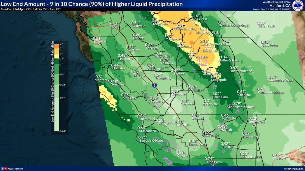
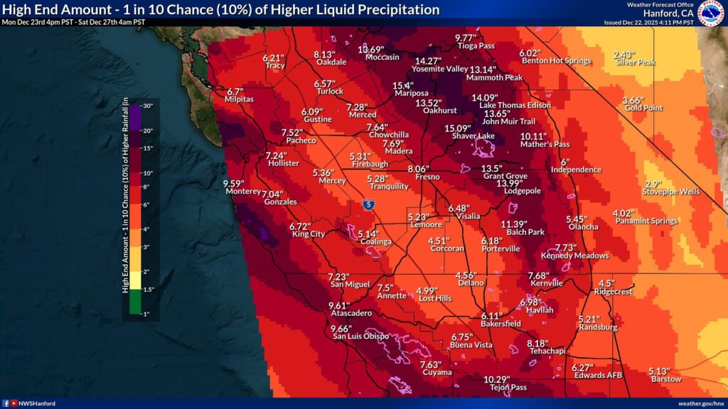
The NWS graphics below indicate Fresno has a 90% chance of receiving at least a half-inch. However, it also has a 10% chance of getting as much as 8 inches.
Think of this situation like the 49ers having both a 90% chance of winning by a point and a 10% chance of winning by 40 points.
Meanwhile, totaling the NWS daily forecast through Friday suggests that Fresno likely will see between 2 and 3 inches of rain.
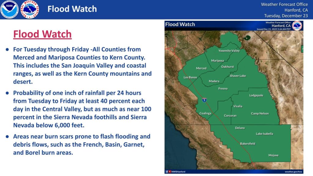
Flood Watch for Valley
Along with the rain comes an NWS Flood Watch for the San Joaquin Valley, coastal ranges, and the Kern County mountains and desert.
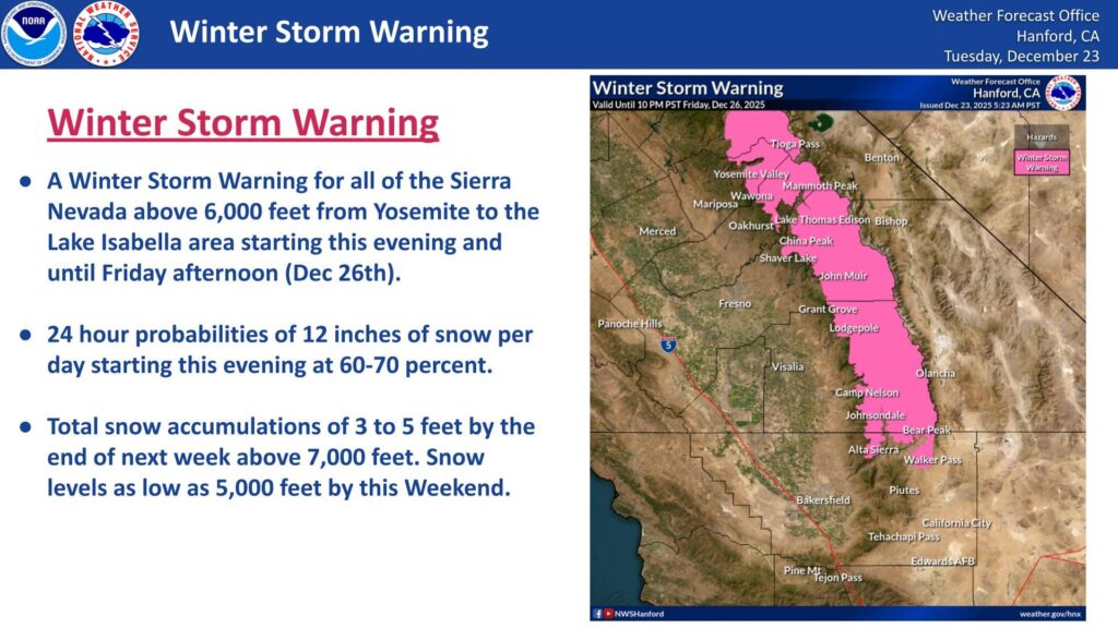
NWS also has issued a Winter Storm Warning for the Sierra between Yosemite National Park and Kern County’s Lake Isabella at elevations above 6,000 feet. It’s possible for the mountains to accumulate as much as six feet of snow from the storm.
In addition, winds of 30 to 40 mph are expected on the Valley’s westside with gusts up to 60 mph. NWS says to watch out for downed trees, especially in the foothills and mountains.